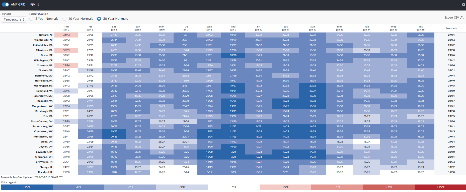
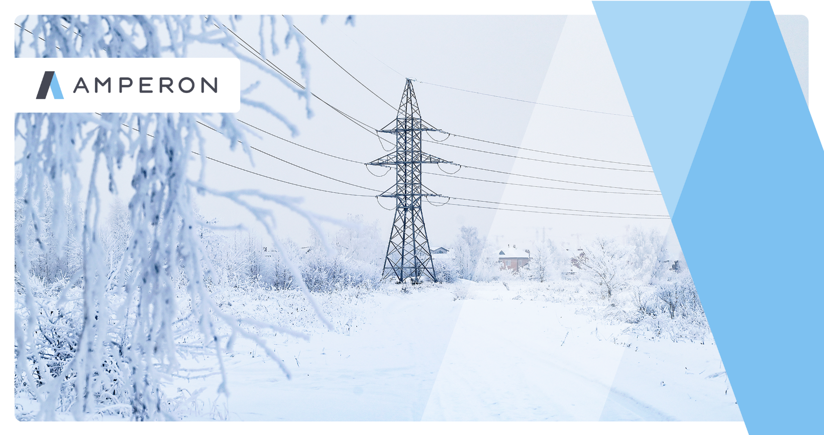
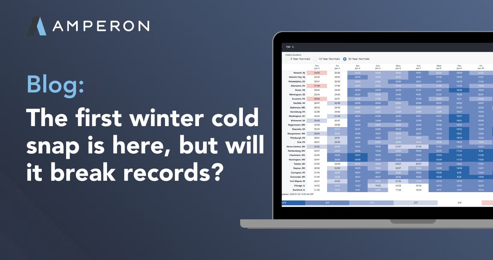
Bundle up! The new year is kicking off with a blast of cold air that’s set to sweep across the eastern United States starting early next week, bringing the longest stretch of frigid temperatures we’ve seen so far this season. Regions like PJM, MISO, SPP, and ERCOT will see elevated demand levels due to these bitter wind chills, likely surpassing demand levels from the early December cold snap. Cold temperatures will stretch as far south as SERC, bringing unnaturally cold temperatures once the sun goes down for these typically temperate states.
What can we expect from the energy markets next week?
Extreme cold temperatures are on the way, but our Chief Meteorologist Dr. Mark Shipham does not anticipate record-breaking conditions like those experienced during MLK weekend in 2024. Temperatures are expected to be mildly colder than what occurred in December. As a result, demand peaks will likely be the highest we've seen this winter, though they will fall short of records.
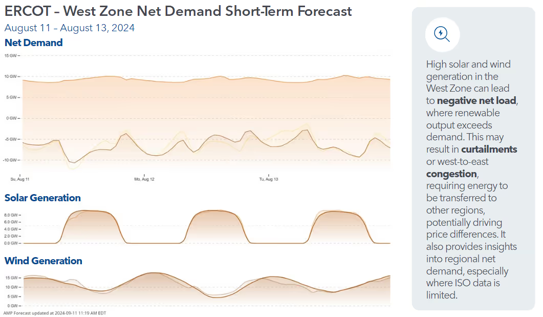
PJM, for instance, has forecasted a winter peak of 141,200 MW, and this event is not expected to approach that level. However, we anticipate elevated energy prices during morning and evening peaks on the coldest days, especially when net demand is high. Regions like SPP and ERCOT, which rely heavily on wind generation, face a greater risk of elevated net demand early next week, as wind output is forecasted to dip below normal during the cold snap.
PJM
Temperatures in PJM are expected to start to drop below the 30-year normal starting Friday the 3rd, with the coldest day currently expected to be the morning of January 9th. As illustrated in the chart below, demand is projected to slightly exceed levels seen earlier this season in December. But we are still not expecting demand to surpass 130 GW, like what we saw last year during the Arctic Blast. However, we are still about a week out from the coldest days, meaning there is still wiggle room in the weather forecast.

MISO
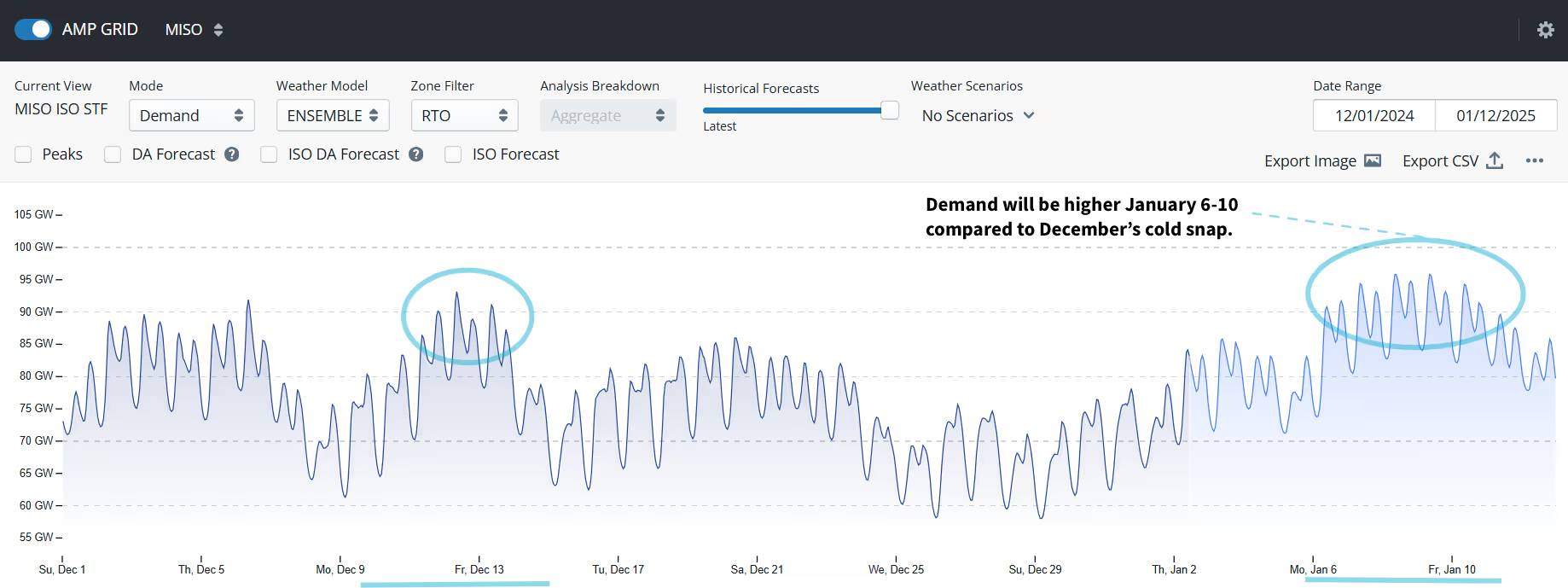
Temperatures will be coldest January 8-11th, with slightly higher demand than last month. During last year’s Arctic Blast, we saw demand levels soar well over 100 GW. With the current weather forecast, we are not expecting this to occur during this period.

ERCOT
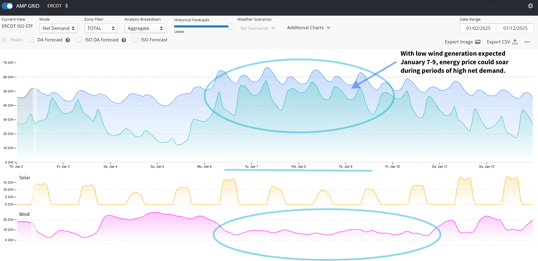
A dramatic shift in temperatures is on the horizon as a cold front sweeps through Sunday night. In some areas, average temperatures are forecasted to plummet by as much as 30 degrees within 24 hours, from Sunday morning to Monday morning. With lower wind generation currently anticipated during the first half of the week, energy prices could soar during periods of high net demand, particularly during the morning and evening peaks.

SPP
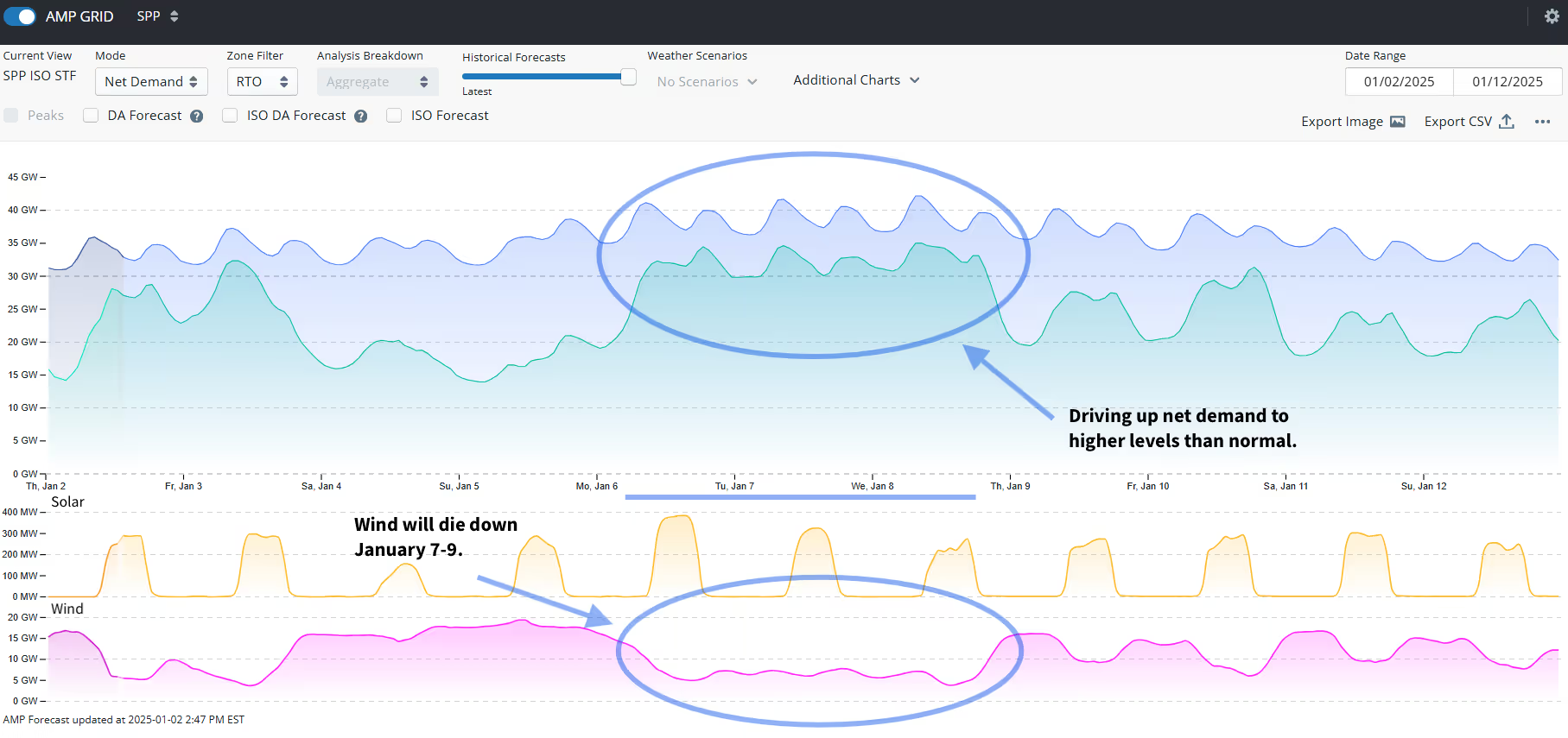
The cold snap will start up north on January 3rd, then eventually make its way down south into Missouri and Oklahoma starting Monday morning. Once the cold front has made its way through the region, wind will die down the first half of the week, driving up net demand to higher levels than normal. This could lead to energy price volatility throughout the day in this wind dependent heavy region.

SERC
SERC will see much colder temperatures than it usually does this time of year, with the cold peaking on January 11th for most of the region. Additionally, winter weather can be expected throughout the region as well.

We are still days away from when the cold snap will hit. It’s always important to have the most up-to-date weather data as these winter storms have the potential of coming in early or staying around longer. Make sure you have the most accurate demand and net demand forecasts as we transition into winter. Reach out if you want to learn more information about Amperon.


.svg)













%20(3).png)
%20(2).png)
%20(1).png)


.png)


.avif)


.avif)

.avif)

.avif)

.avif)
%20(15).avif)
.avif)
%20(10).avif)

.avif)

.avif)
.avif)




.avif)





.avif)

.avif)


