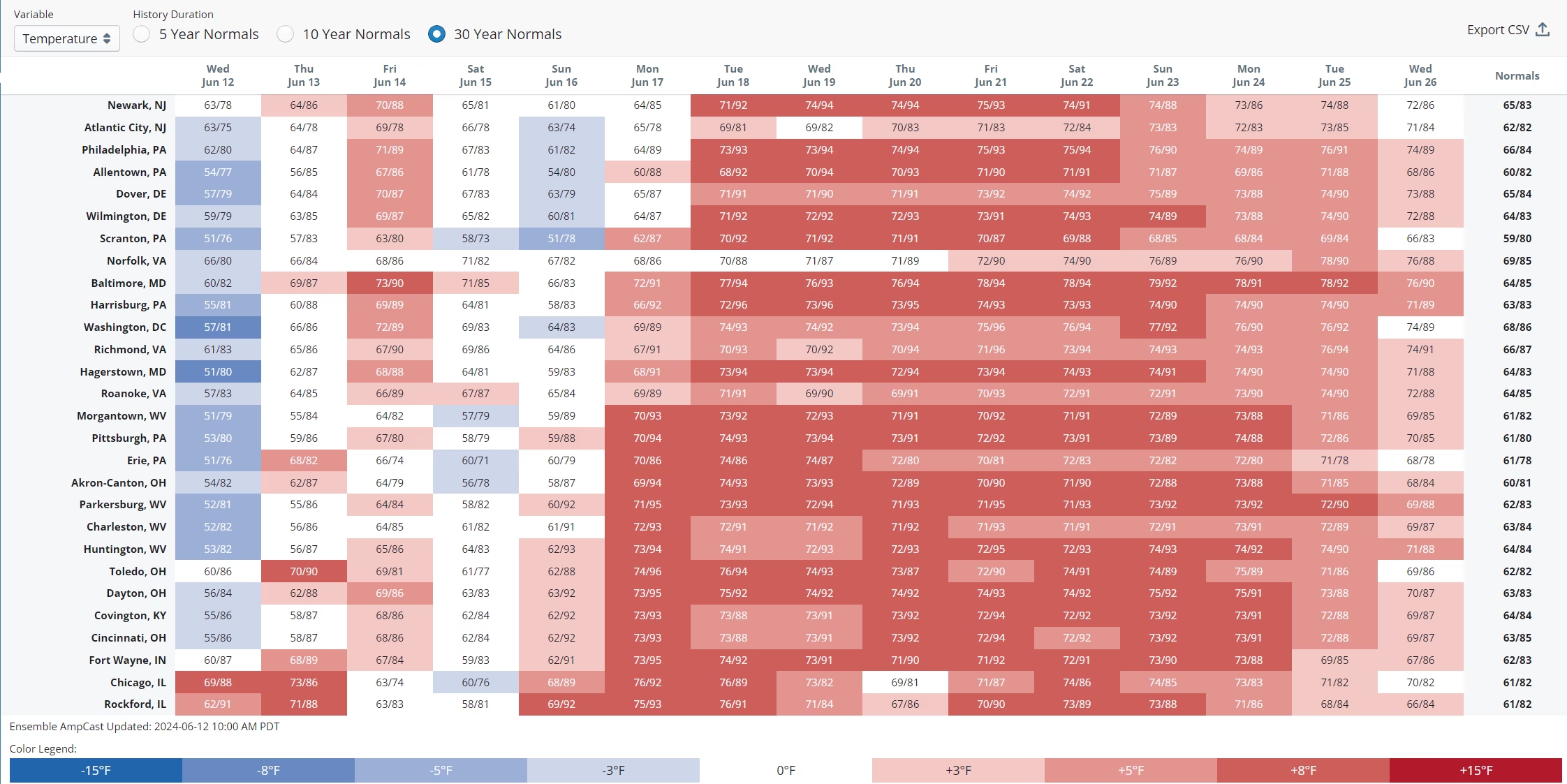
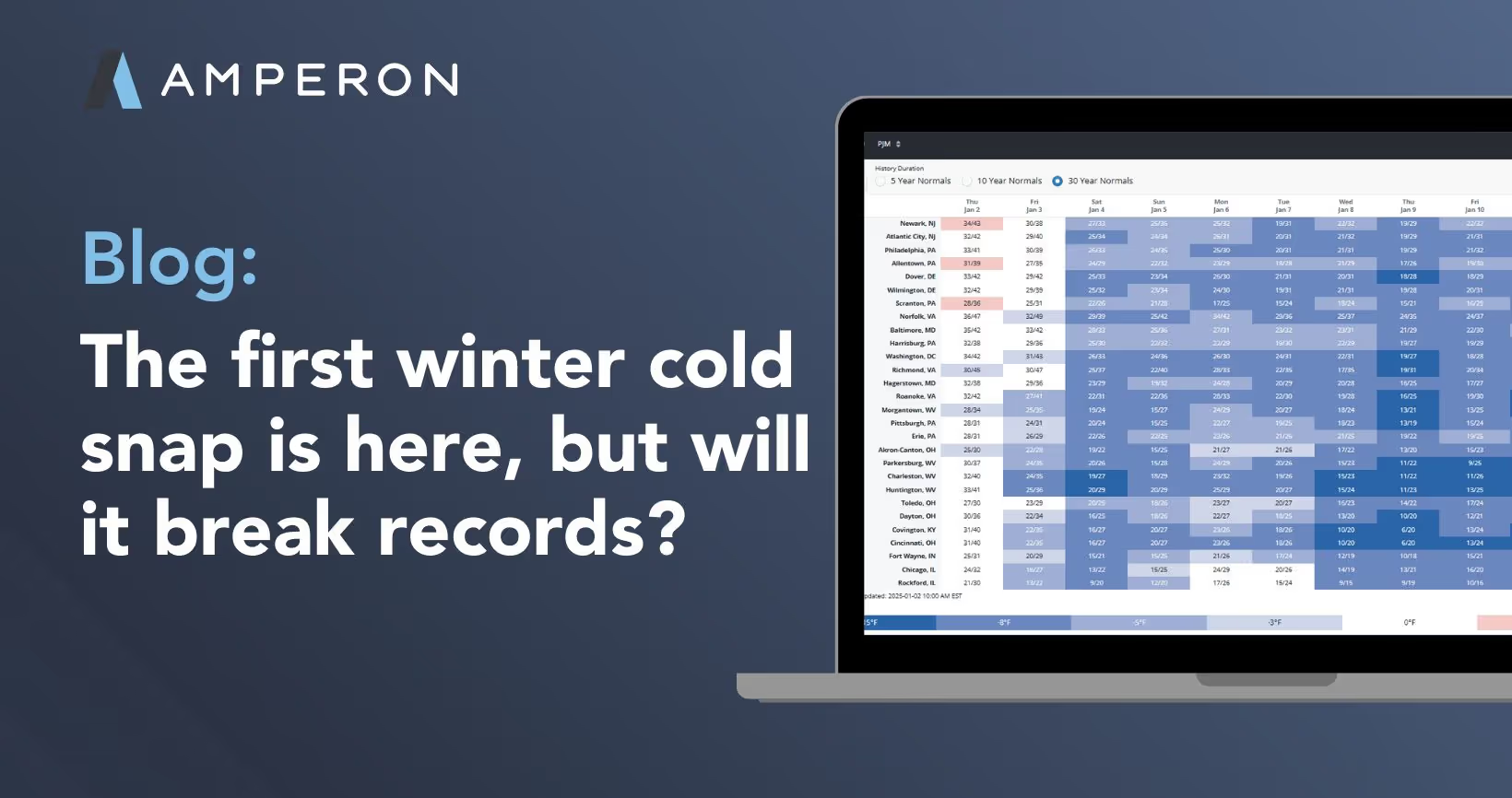
PJM just issued a Hot Weather Alert for June 13th in response to the forecasted 90-degree hot and humid weather in order to prepare the grid for high energy demand. This is likely the first of several Hot Weather Alerts as a prolonged heat wave is expected to bring above normal temperatures to the Eastern US, especially affecting PJM. Starting Monday, major cities throughout the region are forecasted to experience temperatures around 10 degrees above the 30-year normal for the whole week and possibly a little longer. Are you ready for it?
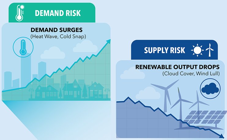
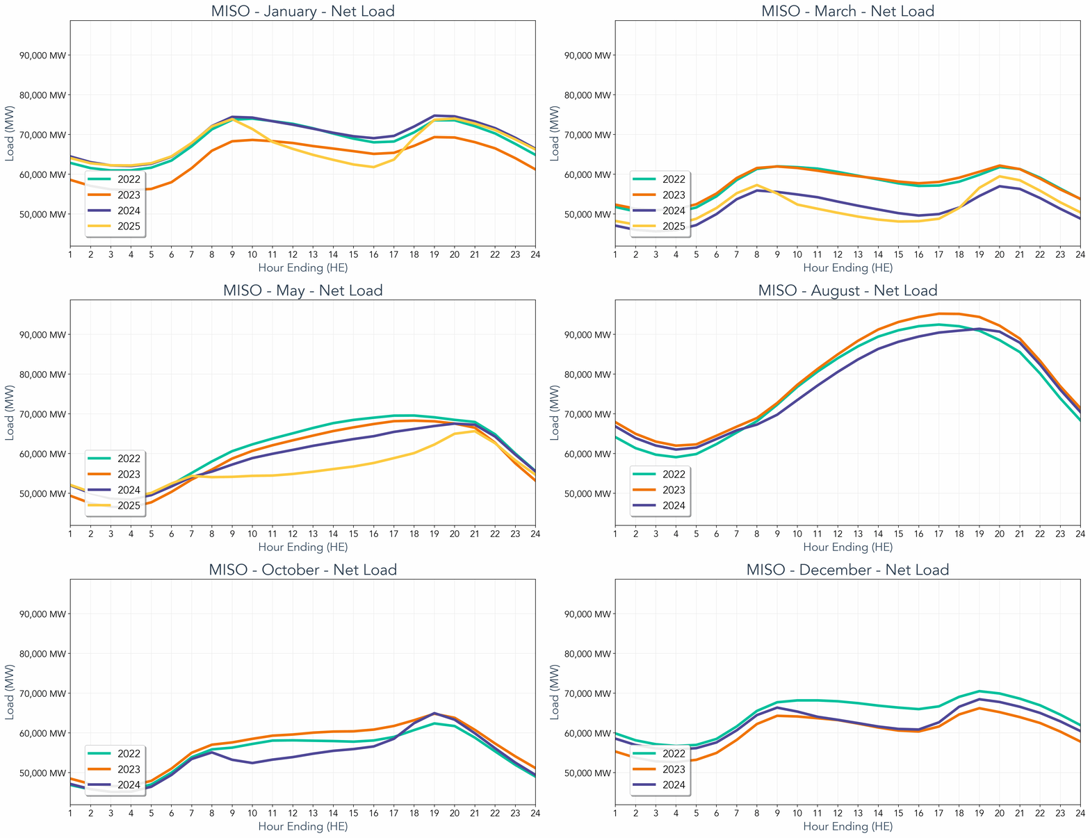
This intense heat will push demand peaks higher than we’ve seen so far this summer. Unlike tomorrow where COMED is expected to experience the biggest impact, the scorching temperatures next week will be more widespread across all of PJM and are expected to persist for at least a week. Next week's demand peaks are expected to surpass tomorrow's numbers, with demand likely to peak in the mid to high-140 GW range for several consecutive days.
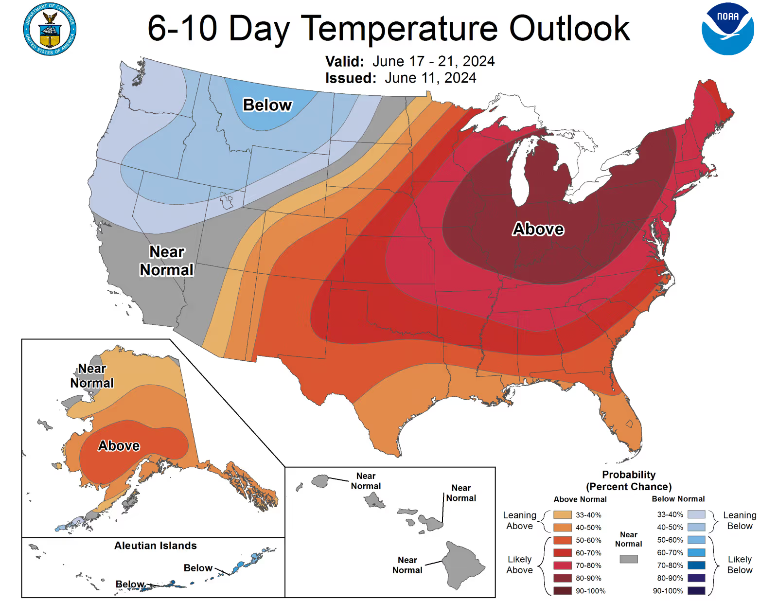
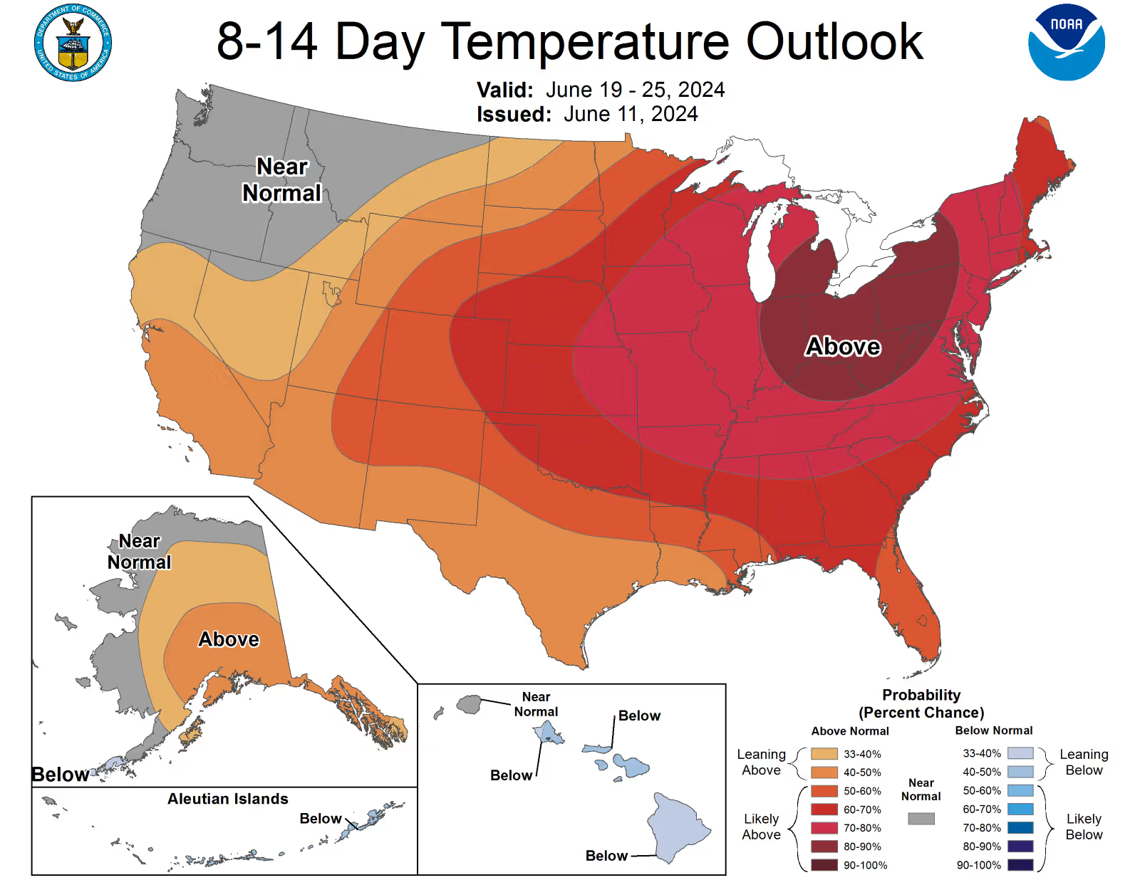
What’s causing this sudden heat? A ridge of high pressure is expected to set up over the Mid-Atlantic and Midwest starting next week, bringing on hot and dry conditions. According to the Climate Prediction Center, above-normal temperatures are favored for nearly all the US, with the largest probabilities (above 80 percent) for areas of the Midwest, Ohio Valley, and Great Lakes, a majority of the PJM regions
Our hourly updates allow you to see how the demand forecasts evolve with the latest weather information. In the summer, a degree warmer has a much greater impact than a degree cooler. With temperatures projected to average in the high 80s to 90s depending on the region, this prolonged heat wave will most certainly put significant stress on our power grid.


.svg)














%20(3).png)
%20(2).png)
%20(1).png)


.png)


.avif)


.avif)

.avif)

.avif)


.avif)
%20(15).avif)

.avif)
%20(10).avif)

.avif)

.avif)
.avif)




.avif)






.avif)

.avif)


